A special thanks to the NASA Landsat Program for featuring our work on their Science Blog
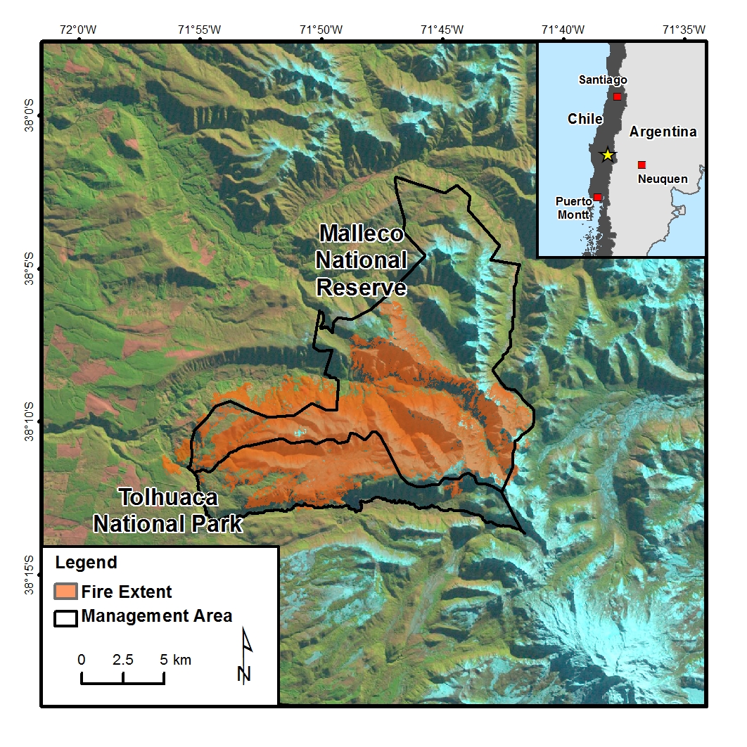
In our new paper, published in the Journal of Biogeography, we investigate postfire regeneration patterns of Araucaria‐Nothofagus forests on the west slope of the Andes Mountains in the Araucanía region of Chile. Specifically, we: a) used satellite data and ground measurements to evaluate the relationship between remotely sensed burn severity and forest mortality; and b) assessed controls of burn severity on forest regeneration at local spatio‐temporal scales. The paper is a product of a collaboration with Colorado State University (Jason Sibold) and the and Universidad Austral de Chile (Mauro González).
We think this work is noteworthy because 1) to our knowledge this is the first study that connects field-measured data with satellite-derived burn severity in this corner of the world; 2) one of the primary species of study, Araucaria araucana (known commonly as monkey puzzle tree), is recognized as an endangered species on the International Union for Conservation of Nature Red List and faces a plethora of threats; and 3) the framework relies on open data, namely Landsat satellite imagery, and could be applied to long-term monitoring or assessment of similar ecosystems. I would go a step further and argue the availability of Landsat data was the primary reason we were able to get this project off the ground.
The paper and data are open access:
- Assal, T.J., González, M.E., and Sibold, J.S., 2018. Burn severity controls on postfire Araucaria‐Nothofagus regeneration in the Andean Cordillera: Journal of Biogeography 45(11):2483-2494
- Assal, T.J., 2018, Burn severity (2002) and field data (2012) from Tolhuaca National Park (Chile): U.S. Geological Survey data release, https://doi.org/10.5066/P9YMIVFU
Top image: Araucaria mortality in Tolhuaca National Park, 10 years postfire, Andes Mountains, Araucania Region, Chile.