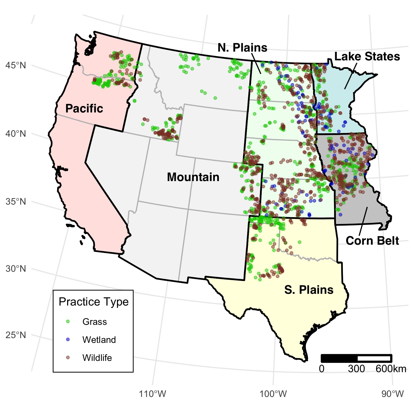
In our new paper, led by my USGS colleague Mark Vandever, we conducted a national evaluation of the effectiveness of the Conservation Reserve Program’s (CRP) intended benefits. We assessed erosional features, vegetation, and soil cover on nearly 1800 fields across 10 conservation practices and 14 central and western states from 2016 to 2018. Overall, results were promising, as we found enrolled wildlife and wetland practices often have diverse perennial vegetation cover and very few erosional features. The work was recently published in the journal Environmental Research Letters.
We think this work is noteworthy because it is the first national-level assessment of CRP establishment in three decades. Accessibility on private land is challenging, but we demonstrated edge-of-field surveys are highly correlated with in-field sampling. The study, funded by the US Dept. of Agriculture, was a big undertaking and involved a massive collaboration across many different research units. However, the broad scale of this study provides managers and policy makers an understanding of the extent to which enrolled CRP fields are meeting goals established by USDA in different states and regions. There is more to come out of this work related to expired CRP fields and tracking the durability of them using satellite data. Stay tuned.
The paper and data are open access:
- Vandever, MW., Carter, SK., Assal, TJ., Elgersma, K., Wen, A., Welty, JL., Arkle, RS., Iovanna, R., 2021. Evaluating establishment of conservation practices in the Conservation Reserve Program across the central and western United States. Environ. Res. Lett. 16, 074011.
- Vandever, MW., Carter, SK., Assal, TJ., Elgersma, K., Wen, A., Welty, JL., Iovanna, R., Arkle, RS., 2021 Presence of erosional features and cover of grasses, forbs, and bare ground on fields enrolled in grassland, wetland, and wildlife practices of the Conservation Reserve Program in the central and western United States from 2016 to 2018: U.S. Geological Survey data release. Reston, Virginia.
Top image: An active CRP Field in the Great Midwest, USA.